Diese Website verwendet Cookies. Durch die Nutzung dieser Webseite erklären Sie sich mit der Verwendung von Cookies einverstanden.

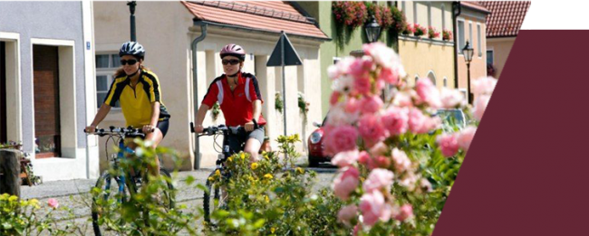
Biking
Biking
INFORMATIONES ABOUT BIKE PATHES
Bike pathes
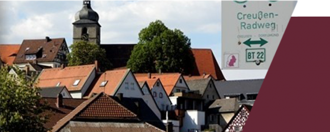
Creußen Cycling path
110,0 km
Creußen Cycling path
110,0 km
From the Glutschaufel directly to the Creußen cycling path
The Creußen cycling path follows the correspondent stream for 45 km. It begins in the city of Creußen and ends in the opening of the Haidenaab at the Haidenaab Cycling path.
Tour guide:
The Creußen cycling path fallows the correspondent stream for 45 km. The tour guides you past Schlammersdorf till the village Moos, were the path splits up.
You now have the choice between route a) that leads you through the nature reserve “Großer Rußweiher next to Eschenbach. Or route b) that leads you through the baroque Premonstratensian-Abby well known monastery Speinshart were you reach Eschenbach. There both paths untie again.
At last the tour takes you past Grafenwöhr with its Culture- and Military museum to your destination Bruchendorfgmünd. On the way you will see special places of interests, like the Root museum in Tremmersdorf or you can take a tour at the brewery Püttner (registration needed).
Length: Creußen 6 km – Altcreußen 7 km – Schlammersdorf 15 km – Eschenbach 10 km – Grafenwöhr
Street variation: Asphalt, Forest road, less driven roads
Length: 110 km
Altitude difference: 492m
More information: https://www.oberpfaelzerwald.de/creussen-radweg
Brewery path - NEW 16
45,6 km
Brewery path - NEW 16
45,6 km
From Kirchenthumbach over Schlammersdorf (“Braumoister”), along the former Zoigl-city Eschenbach and back to Heberbräu in Kirchenthumbach.
Tour guide:
Starting at the market place of Kirchenthumbach you will go past Burggrub up to Wölkersdorf. The path will be on the state road but it offers you a wonderful view to the Rauhen Kulm and also to the Fichtelgebirge. After the downhill into the Creußental and a little side trip in the close by Oberfranken you will enter Vorbach Schlammersdorf with its well-known Brewery restaurant. Hidden in the Mooser woods lies a archeologic place of discovery “Biestubn” which is a strange rotunda from the middle age.
At a chain of lakes you will go further through the woods. Forrest and water animals of special sort are spotted in the Root museum of Tremmersdorf. The following rise will be rewarded by another view of the Rauhe Kulm, but this time, with the monastery Speinshart in front of it, bevor you come back to the Eschenbacher Lake chain.
While the Big Rußweiher, as a Bird reserve, provides many animals a living environment – the little Rußweiher is attractive due it recreational facility’s.
The Service spot “Hexenhäusl” will give you information about the nature park North Oberpfälzer Wald and the Geopark Bavaria – Böhmen. In the Eschenbacher old city alleys the old Malzhaus and the Taubnschusterhaus can testify about the Zoigl brewing tradition. On the other side of the stretched Rußweiher and over the idyllic laid Metenhof you will get back to Kirchenthumbach were the cycling tour can end at the Heberbräu Beer garden.
Length: 45,6 km
Altitude difference: 546 m
More information: https://www.oberpfaelzerwald.de/new-16-brauereienweg
From Netzaberg to Barbaraberg - NEW 22
26,2 km
From Netzaberg to Barbaraberg - NEW 22
26,2 km
Two mountain rages with the changeful settlement history:
The American “Newtown”, on top of the Netzaberg- and the Barbaraberg with its skalvisch Graveyard field.
Tour guide:
A good starting point for the tour would be the Zimmermannsplatz below the City-church St. Laurentius in Eschenbach. On the cycling path you will reach the base of the Netzaberg. On this ridge, at the border of the military base Grafenwöhr, there was a new “Housing area” build in the years between 2006 – 2008, which habituated around 800 House for US-Soldiers and their families.
The cycling tour NEW 22 stays at first next to the state road and brings you past the villages Thomasreuth and Runkenreuth. Going through Trag you will have a comfortable scroll into the valley of Eschenbach and Creußen. This small river has to be crossed over a tiny wooden bridge were the bikes have to be pushed!
Passing Zettlitz the rise of the tour will be more challenging. It goes up hill of the long starched Hellerberg. In Pichlberg, the water-adventure-park, in the middle of the village will invite you to take a rest. The Pichlberger crossing (about 50m besides the trail) opends a beautiful glimbs towards the Hessenreuther woods and the Stone woods. The mountain chain will increase to the Barbaraberg where there has been a Christian Church since the 11th century. Even older than that, is the skalvisch Graveyard field, whose Info panel shows the Geopark Bavarias and Böhmens. Of the once former Rokoko-Church of Pilgrimage, today only the foundation walls are maintained as well as the façade that looks down to the monastery of Speinshart.
The next stage you will reach through a shady downhill going past the Restaurant Süßenweiher. Using the welcoming Northern gate, you will end up at the monastery Speinshart with its overwhelming church. In the nearby village Tremmersdorf you can visit the original Root museum before you end your cycling tour in Eschenbach.
Length: 26,2 km
Altitude difference: 197 m
More information: https://www.oberpfaelzerwald.de/new-22-vom-netzaberg-zum-barbaraberg
Founder-Bike path - NEW 21
32,8 km
Founder-Bike path - NEW 21
32,8 km
Besides the main road there is a cycling path that connects the City-triangle Grafenwöhr – Eschenbach – Pressath from which there was an cooperation’s agreement made for the forth-city-triangle.
Tour guide:
1977 the city-triangle Grafenwöhr , Eschenbach, Pressath opened the Fonder center in Gmünd. For this occasion there were Hiking- and Biking trails created to connect the three Places.
You will leave Grafenwöhr over the Annaberg. After you take a glimbs at the US-military training ground in the South, there will be a view opening in the North direction where you can look from the Rauhe Kulm all the way to the Fichtelgebirge.
Partially going on the former train rail you will reach Eschenbach with its beautiful City hill. At the Hammermühle the path crosses the river Creußen before you leave Zettlitz and go uphill towards Pichlberg.
Passing Feilersdorf you will enter the Haidenaab and forther to Zintlhammer. Over the valley will rise the historic center of Pressath with the parish church St. Georg. On the other side of the river you can rest at the Kahrmühle before the path takes you to the Bürgerwoods and finally ends at the Sport center with Shooting club and hidden Pool in the City of Grafenwöhr.
Length: 32,8 km
Altitude difference: 214 m
More informationen: https://www.oberpfaelzerwald.de/new-21-gruender-radweg
Tour of the superlative for adventurers
115,0 km
Tour of the superlative for adventurers
115,0 km
Tour round from Eschenbach: Some of the highlights of the Oberpfälzer woods on one single tour. Not just for Culture-, Nature- and Geographic lovers!
Tour guide:
The tour that was intended as a tour for more days, is not only for nature- culture and geographic lovers but as well as for epicure and Zoiglfans worthy. From the E-Bike station Hexenhäusl started, through the leisure lake and nature reserve in Eschenbach in der Oberpfalz to the baroque monastery Speinshart, one of the nicest monastery villages of south Germany, going from Germanys beautiful nature wonder, the volcano Rauher Kulm to the continental onshore well with its deep borehole and highest ground drilling ring of the planet in the “Zoiglhauptstadt” Windischeschenbach and over the historical lead Kristal center Neustadt an der Waldnaab to Parkstein, the finest Basaltkegel Europe with volcanic eruption ever hour at the museum. This 115 km long experience of special kind promises to have leaving impressions.
Length: 115,0 km
Altitude difference 929 m
More informations: https://www.oberpfaelzerwald.de/tour-der-superlative-fuer-entdecker