Diese Website verwendet Cookies. Durch die Nutzung dieser Webseite erklären Sie sich mit der Verwendung von Cookies einverstanden.
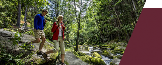
Hiking
Hiking
INFORMATION ABOUT HIKING TRAILS
Hiking trails
Hiking at the Glutschaufel
Hiking at the Glutschaufel
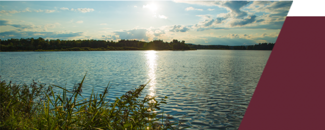
Hiking around the "Big Rußweiher"
Tourguide:
The „Big Rußweiher“ infront of our door, is one of the oldest Lakes from the Eschenbacher Lake area. It was created by the Monks, that lived in the nearby Monastery in Speinshart, in the early 15th century.
Due to its meaning as a Bird-breeding area, the Rußweiher – and later even the Eschenbacher Lake area was one of the first Nature reserves claimed in Bavaria.
Today the hiker can follow the marked path around the Big Rußweiher. He can also marvel the colorful Bird- and Plant world by standing on the high Viewpoint.
The small Rußweiher can be used as a perfect Beach-pool.
Length about: 6.6 km
More information: https://www.oberpfaelzerwald.de/naturerlebnis-russweihergebiet
Founder Path at the Urban-City-triangle in the Oberpfälzer Hillcountry
Tourguide:
The hiking path will take you around the City triangle Grafenwöhr, Eschenbach i.d.Opf and Pressath. Long distances throw woods, wonderful views, tiny villages, former train rails and small rivers will make your hike from City to City a varied nature pleasure. It will not only show you the beauty of the landscape but also the places of interest of the Oberpfälzer Hill-country.
Not to forget the “historical goods” in these three citys that have shopping,- eating and accommodations available.
Length about: 34,0 km
More information: https://www.oberpfaelzerwald.de/gruenderweg-im-staedtedreieck
Waldnaabtal / Doost
Waldnaabtal / Doost
Waldnaabtal
An Eldorado for Natur lovers
Discover the wild-romantic and the pristine nature reserve between Falkenberg und Windischeschenbach.
On the quality path Goldsteig from Falkenberg to Windischeschenbach, hikers can reach a unique nature reserve – the Waldnaabtal.
It is marked by very high climbing cliff sculptures and an extra ordinary flora and fauna. Extra green fernleafs, gentle colored flowers, pale birch and beech trees, silver crests and the white crestwave of the water give the valley a mystical character. For hardworking hikers, there will be a Blockhouse waiting in the middle of the Valley, which has one of the nicest Beergardens in the Oberpfalz (closed Mondays). The path between the Blockhouse and Neuhaus is an incredible adventure playground for kids and youthful adults. Information signs tell stories of old tales and of long vanished castles. The 12 km long Canyon with about 40 m high Granit rooks is very well marked with Hiking- and Bikingpaths.
Possible Tours:
Classic Hiking round in the wild-romantic Waldnaabtal (Length: 12,2 km)
Short Hiking round throw the Waldnaabtal (Length: 7,1 km)
More hiking trails throught the Waldnaabtal
Throw the Nature reserve Doost to the Gallows
From a mystical Nature reserve to promising hights
Tourguide:
Throw the Nature reserve Doost and a collection of Granit boulders, that seem like they have been placed by ghosts into the Girnitz-stream, the path takes you over Wilchenreuth to Theisseil and up on the mountain chain of the Floss area, all the way to the gallows. In the past it was a place of execution from the department of Floss over the city of Floss.
Length: 12,5 km
More information: https://www.oberpfaelzerwald.de/durch-das-naturschutzgebiet-doost-zum-galgen

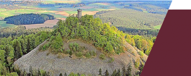
Rauher Kulm
Rauher Kulm
The Rauhe Kulm is a volcano that never has erupted.
2013 it was priced as the loveliest natural wonder by the Heinz Seilmann foundation.
A hike around the Rauhe Kulm has surprising views and one or the other surprising natural histories. The Basalt boulder pile and also the historical rock-cut cellar around the hill habitats rare animals and plants.
On Information signs you will find everything about the Nature and Landscape around the hill.
View the hiking trails
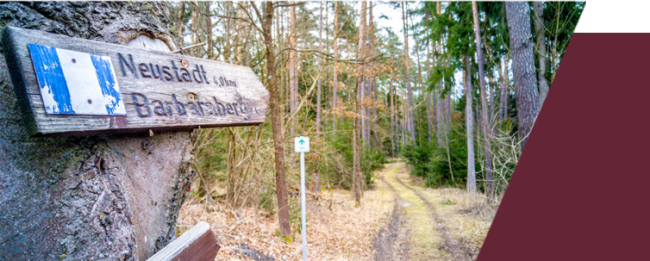
Barbararberg
Barbararberg
Pilgrim path from the monastery Speinshart to Barbaraberg
There is an old pilgrims path that leads you from the monastery Speinshart up the hill of the Barbaraberg. The path is filled by baroque Holy figures. Hikers and Pilgrims enjoy walking here.
Length: 5,87 km (towards and back)
There is an old pilgrims path that leads you from the monastery Speinshart up the hill of the Barbaraberg. The path is filled by baroque Holy figures. Hikers and Pilgrims enjoy walking here.
Length: 5,87 km (towards and back)